The useful moment is not when a circular feature on satellite view starts to look like a crater. It is the next thirty seconds, when you either save enough context to return to it later or leave yourself a mystery pin named something like "weird lake." If you are using Google Maps for note-taking meteorite craters, the goal is not to prove anything from your screen. The goal is to build a record that survives your first burst of curiosity.
That distinction matters after the Uhackatik story. In 2026, Smithsonian reported that amateur astronomer Joël Lapointe noticed a near-perfect ring in Google Maps while planning a camping trip in Quebec's Côte-Nord region. Later field expeditions in October 2025 found shatter cones and impact melt rock, and the structure was reported as a roughly 390-million-year-old meteorite impact crater about 15.5 miles wide.[1]
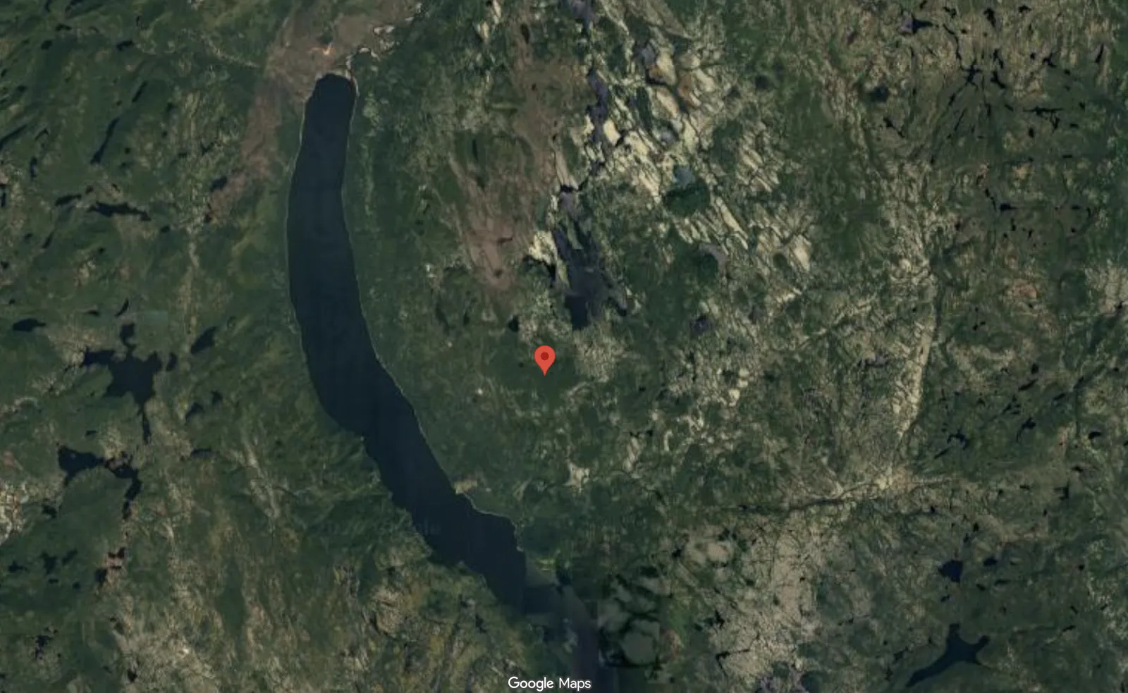
The screen was only the beginning. Live Science quoted Western University planetary geologist Gordon Osinski calling the later work "one of the most arduous expeditions I've ever done," a useful antidote to the idea that remote viewing alone confirms a crater.[2] As of July 23, 2026, the reported Uhackatik work also needs the peer-review caveat kept visible: the Meteoritical Society Meeting presentation scheduled for August 2026 has not happened yet.
So this starts modestly. Save the interesting place. Label what you think you saw. Move it into a catalog where the status is impossible to miss. Keep candidate notes separate from confirmed craters. Google Maps and Google My Maps are not scientific databases, but with a disciplined structure they can act like a free crater notebook.
Use Saved Places as the fast capture inbox
When you notice a suspicious ring, basin, circular lake, or oddly complete arc, do not start by building the perfect entry. Save it quickly. In Google Maps, drop a pin, save it to a dedicated list, and write a plain note about why it caught your eye. That list is your inbox, not your final catalog.
A Saved Places list is useful because it is low-friction and mobile. Lists sync across devices, and saved areas can still be useful when paired with downloaded offline maps. The weakness is classification: saved pins use identical icons, so a list full of possible craters, confirmed craters, campsites, road access points, and "check this later" locations becomes hard to read visually.[3]
| When you see it | Save this much before moving on |
|---|---|
| A circular lake or ring feature | Pin location, short note, screenshot if possible |
| A known crater you want to study | Name, source, confirmation status |
| A possible access or viewpoint | Why it matters: road, trail, public land, nearby town |
| A vague feature you are unsure about | Label it as uncertain instead of improving the story later from memory |
The first note can be boring. Boring is good. "Near circular lake, raised-looking rim on north side, seen in satellite view while scanning Quebec" is far more useful than "possible crater???" six months later. If you can, add a screenshot to your own files with the same provisional name you used for the pin.
Move saved pins into My Maps before the inbox gets sentimental
Saved Places is where a thought lands. Google My Maps is where it becomes a record. My Maps lets you build a custom map with layers, per-pin descriptions, custom colors or icons, photos, videos, spreadsheet imports, and KML export. Google's own Help documentation says a map can contain up to 10,000 lines, shapes, or places, with up to 2,000 items per layer.[4]
Those limits are roomy for this use case. Earth has only about 200 confirmed impact craters, and Live Science reported that only one or two new craters are typically discovered per year; Canada was reported as having 31 confirmed impact craters after Uhackatik, more than any other country, and its previous confirmed crater was in 2010.[2] A personal map can hold the known crater set, your candidates, rejected lookalikes, and access notes without getting close to the overall ceiling.
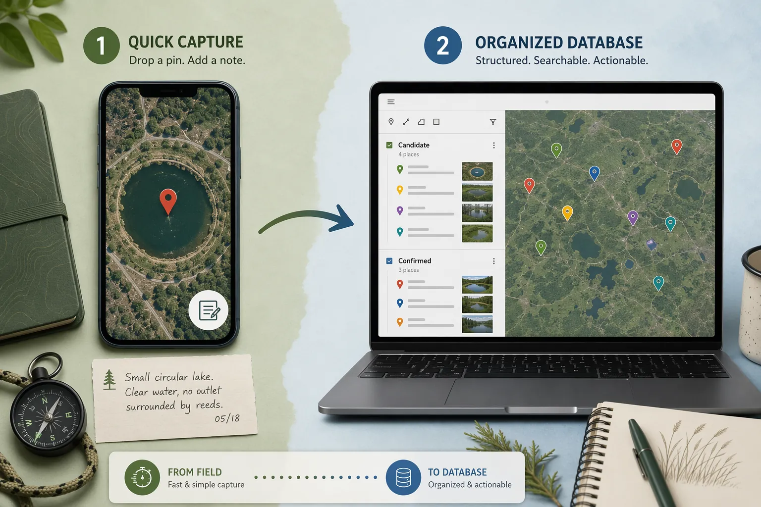
The handoff is where most amateur catalogs either become useful or become a junk drawer. Set a regular rule: anything that still interests you after first capture gets copied into My Maps with a structured name, a status, and a minimum set of fields. Anything too vague to describe honestly can stay in the inbox until you have a reason to promote it.
A simple transfer routine
- Open the saved pin in Google Maps and copy the coordinates or location.
- Open your crater notebook in Google My Maps and add a marker at the same location.
- Rename the marker using the status convention before adding any longer notes.
- Paste the original quick note into the description so the first observation is preserved.
- Add source, diameter estimate, age field, and image links or uploads if you have them.
- Only after the My Maps entry exists, decide whether to remove the item from your Saved Places inbox.
Keeping the first observation matters. Later research can make you overconfident. A preserved first note shows what was actually visible at the time: a ring, a drainage pattern, a lake shape, a resemblance to a known structure, or just a hunch worth checking.
Make the status visible in the name
Use this naming convention as the spine of the notebook:
[Region] - [Name] - [Status: Candidate/Confirmed]For an established crater, the name might look like "Quebec - Uhackatik - Status: Confirmed" if you are cataloging it after consulting the reported field evidence and keeping the peer-review caveat in the description. For your own observation, use something plainer: "Northern Ontario - Unnamed Ring Lake A - Status: Candidate." If you later decide the feature is probably glacial, volcanic, erosional, artificial, or simply too ambiguous, change the status instead of deleting the history.
| Status | Use it when | What it prevents |
|---|---|---|
| Candidate | You noticed a circular or ring-like feature worth revisiting | Treating visual resemblance as evidence |
| Confirmed | A credible source reports accepted impact evidence | Mixing known craters with personal guesses |
| Rejected | You found a better explanation or the feature no longer holds up | Rediscovering the same false lead later |
| Needs source | You have a name or claim but have not traced it to a reliable reference | Letting folklore harden into a catalog entry |
Putting status in the marker name may feel redundant if you already use layers or colors. It is not. Names survive exports, screenshots, shared links, and hurried browsing better than color systems do. If someone else opens the map, the status should be visible before they read the description.
Layers can still do useful work. Keep "Confirmed craters," "Candidates," "Rejected or explained features," and "Field logistics" as separate layers if that matches how you think. Use custom icons or colors for quick scanning. Just do not make color the only place where the scientific status lives.
Give every crater entry the same minimum fields
A crater notebook is not improved by long prose if the basic facts are missing. The description field in My Maps should begin with repeatable fields, then leave room for free notes. The point is not to imitate a formal database perfectly; it is to keep tomorrow's version of you from guessing what today's version meant.
| Field | What to write | Use for candidates? |
|---|---|---|
| Coordinates | Latitude and longitude copied from the map or source | Yes |
| Estimated diameter | A rough measurement from the map tool or source; label estimates clearly | Yes |
| Known or estimated age | Use a sourced age for confirmed craters; write unknown if you do not have one | Only if clearly sourced or marked unknown |
| Source | Article, database, paper, personal scan, or field note that led to the entry | Yes |
| Personal notes | What caught your eye and what still needs checking | Yes |
| Attached images | Screenshots, field photos, or reference images when allowed by your source | Yes |
For a candidate, the source might simply be "personal scan of Google Maps satellite view, saved July 2026." That is acceptable as long as the status stays Candidate. For a confirmed crater, the source should point to a database, institution, article, or paper rather than your memory of having seen the name somewhere.
Images are especially helpful for features that change visually depending on zoom level, season, or map layer. Add a screenshot that shows the whole ring and another closer crop if the detail matters. If you attach field photos later, label them as field photos, not as proof. A photograph of a rock is not the same thing as an interpreted geological sample.
Separate remote screening from confirmation
Circular shapes are common on Earth. Lakes, volcanic structures, salt domes, erosion patterns, glacial features, reefs, human excavation, and coincidence can all produce satisfying circles from above. A map pin can preserve a lead; it cannot validate an impact origin.
The citizen-science precedent is real, but it is narrower than the fantasy version. Forbes reported in 2020 that the Vigie-Cratère project had identified more than 3,600 potential impact structures using shaded relief topographic data that could be viewed alongside satellite imagery in Google Earth.[5] That figure shows the scale of systematic remote screening. It does not mean thousands of those candidates will become confirmed craters.
Uhackatik is a good model precisely because the story did not stop at the visible ring. The later reporting points to field evidence: shatter cones and impact melt rock.[1] Those are the kinds of observations that move a structure out of the realm of "interesting from orbit" and into scientific evaluation. Your Google map should reflect that boundary by keeping Candidate, Confirmed, Rejected, and Needs source entries visibly distinct.
A practical description template
Status:
Coordinates:
Estimated diameter:
Known or estimated age:
Source:
Why saved:
Visible features:
Images attached:
Next check:
Notes:
The "Next check" line is small but useful. It gives the entry a future action without pretending the action is proof. Examples: compare with topographic data, look for a named lake or local geology reference, check whether it appears in an impact crater database, or mark as rejected if the shape follows an obvious river bend.
Use imports when the map becomes a catalog
Manual pins are fine at the beginning. Once you start maintaining dozens of entries, a spreadsheet becomes cleaner. My Maps supports spreadsheet import, which means you can keep columns for name, coordinates, status, diameter, age, source, and notes, then import or update a layer from that table.[4]
This is also the safest way to add known craters without mixing them with your personal candidates. Put confirmed craters in one spreadsheet tab or layer, candidates in another, and rejected features somewhere visible enough that you do not keep re-saving the same lookalike. A rejected layer is not clutter; it is institutional memory for a one-person project.
| Layer | Good contents | Avoid putting here |
|---|---|---|
| Confirmed craters | Sourced entries with accepted or reported impact evidence | Personal visual candidates |
| Candidates | Features you want to research further | Claims written as conclusions |
| Rejected or explained | False leads with the reason they were downgraded | Embarrassing old guesses you are tempted to erase |
| Logistics | Roads, access notes, viewpoints, nearby towns | Scientific status labels |
The capacity numbers make this approach practical rather than precious. With up to 2,000 items per layer and up to 10,000 total map items, the constraint is not storage for an amateur crater notebook; it is discipline.[4] The map will fail earlier from vague names, duplicate pins, and missing sources than from Google's item limit.
Share and export without losing the caveats
My Maps can be shared with view or edit permissions, and it can export KML.[4] Sharing is helpful if your astronomy club, geology group, or field partner wants to review candidates together. It also raises the cost of sloppy labels. A private pin named "maybe real crater" is a personal nuisance. A shared pin with that name is how uncertainty turns into rumor.
Before sharing, scan the map for three things: every candidate says Candidate, every confirmed crater has a source, and every uncertain inherited claim is marked Needs source. If someone else can edit the map, ask them to preserve the status field and add their initials or date to major changes. That is not bureaucracy; it is how you keep a collaborative map from becoming a scrapbook.
Export also gives you a way out if your system grows beyond Google tools. KML is useful for moving map data into other geographic software, and Saved Places data can be exported through Google Takeout.[3][4] You do not need to start there, but it is reassuring to know that the notebook is not trapped inside a single view.
What Google Maps can and cannot do for crater notes
Google Maps can help you notice, save, compare, label, revisit, share, and export crater-related observations. Saved Places gives you the fast inbox. My Maps gives you the structured catalog. The naming convention supplies the scientific caution that generic consumer mapping tools do not provide on their own.
It cannot tell you that a circular lake is an impact crater. It cannot distinguish a beautiful candidate from a common landform just because the outline is persuasive. It cannot replace field evidence, expert interpretation, or peer review.
That still leaves plenty worth doing. A careful amateur notebook is not a declaration machine; it is a way to make curiosity durable. Save the ring. Name it plainly. Mark it Candidate until the evidence says otherwise. Months later, when someone asks why that pin exists, the map should be able to answer.
References
- An Amateur Astronomer Using Google Maps Spotted a Strange Indentation. It Turned Out to Be a Meteorite Crater From 390 Million Years Ago, Smithsonian Magazine, July 23, 2026.
- 'This was one of the most arduous expeditions I've ever done'..., Live Science, July 23, 2026.
- Google Maps Saved Places: How to Unleash its Full Potential, The Unconventional Route.
- Add places to your map, Google My Maps Help.
- How To Discover Your Own Massive Meteorite Crater (And Still Work From Home), Forbes, 2020.